Aerial Information Solutions Company
for Limited Unmanned Aircraft
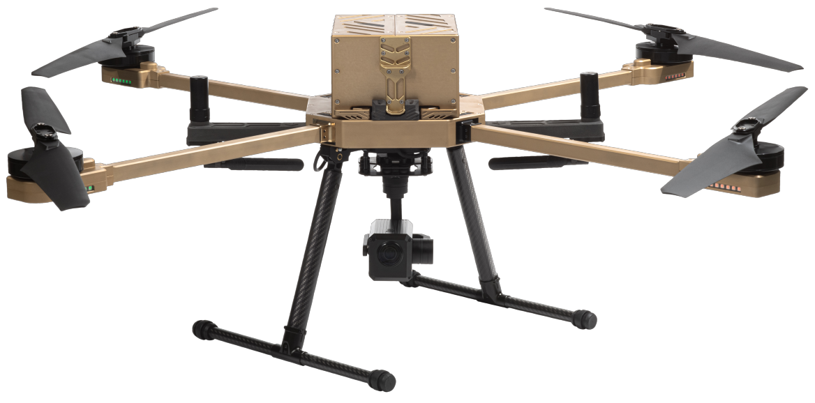
Both Geographic Information Systems, remote sensing, digital photogrammetry, and general surveying have reached advanced stages in modeling the Earth's surface in its true dimensions and with high accuracy, creating a comprehensive and effective technological revolution that provides quick and suitable solutions to address the challenges of the measurement, exploration, and remote monitoring world for large projects, extensive vegetation, elevated and rugged areas, and vast deserts. The Limited Company for Aerial Information Solutions for Unmanned Aircraft was established in 2019 and operates in the field of aerial imaging and surveying, monitoring vegetation and the environment, modeling and visualization for governmental, civil, agricultural, industrial, tourism, archaeological, and academic purposes and uses. It owns a range of professional multi-purpose unmanned aircraft and various ground surveying devices, enabling the company to overcome different conditions and challenges for difficult and vast projects and sites using modern technologies and software, managed by specialized Saudi youth with distinguished expertise in management, engineering, geographic information systems, remote sensing, digital photogrammetry, and ground surveying.

Aerial Survey and Maps
The company offers photography and mapping services with a comprehensive operation from a professional and scientific team equipped with geographic information systems and modern digital aerial surveying technologies. Field data is collected using high-resolution cameras of up to 61 megapixels, mounted on professional drones equipped with global positioning technology and supported by post-processing correction techniques and real-time correction techniques.

Monitoring Vegetation and Soil Moisture
We are working on monitoring vegetation cover, plant health, and soil moisture using remote sensing technologies. The field team collects the required field data using multispectral sensors that cover up to 14 spectral bands with a resolution of 12 megapixels, thermal sensors that operate efficiently and effectively to represent reality, high-resolution cameras, and those mounted on drones equipped with global positioning technology supported by real-time correction techniques. The data analysis team provides a variety of specialized services.

3D modeling and
sculpting
The company offers three-dimensional modeling and prototyping services through a complete operation by a professional and scientific team equipped with modern digital photogrammetry technologies. The field team studies the site conditions thoroughly, then collects the required field data using high-resolution cameras or high-resolution LiDAR, mounted on drones equipped with global positioning technology and supported by post-processing correction techniques and real-time correction techniques. The laboratory and scientific team works to provide various specialized services.

Measuring Emissions and Environmental Pollution
The company provides exploration, environmental assessment, and impact measurement services. It analyzes air and water quality, and monitors changes in vegetation. It provides accurate reports on the impact of human projects on the environment, helping to save time and effort in effectively assessing environmental impact.
Our Numbers ..
1000
Flight trip
Flight plans and various trips have been executed and drawn up, exceeding 1,000 flights.
60
Client
Our clients include government entities, research centers, educational institutions, consulting and engineering offices.
500
500 km² aerial photography
Extensive areas have been covered including city outskirts, large parks, projects of interest, geological sites, and archaeological sites.
4
Areas of
Interest
Several fields have been covered such as mapping, aerial surveying, vegetation and soil, urbanization and antiquities, environmental pollution, geology.
6
Categories of cameras and sensors
The company has a diverse range of high-resolution cameras, lidar, multispectral sensors, and gas sensors.
Aerial Information Solutions for Unmanned Aircraft Limited has a team of specialized experts in geographic information systems, remote sensing, digital photogrammetry, digital modeling, surveying, and more.. It has consultants who have brought their deep expertise and specialties to the company.
Aerial Information Solutions guarantees you amazing results
80% time savings - 60% lower cost - 98% higher quality compared to traditional work - 100% safe